Chamorga-la Cumbrilla-Lomo las Bodegas-Cabezo del Tejo-Tafada-Chamorga
Interactive map
GPS track profile
About this GPS track
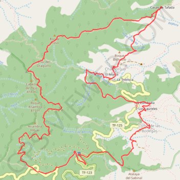
Name: Chamorga-la Cumbrilla-Lomo las Bodegas-Cabezo del Tejo-Tafada-Chamorga GPS track, route, trail
Coordinates: 28.55772 -16.17189 28.57719 -16.15266
Other GPS tracks
Click on a GPS track to view route, its statistics and profile.
Faro de Anaga
Espagne > Santa Cruz de Ténérife
Benijo - Roque Bermejo. #Randonnée
Distance: 7.1 Km • Elevation gain: 674 m • Maximum elevation: 309 m
Anaga : Chamorga - Faro de Anago
Espagne > Santa Cruz de Ténérife
Distance: 7.7 Km • Elevation gain: 657 m • Maximum elevation: 612 m
Ten_65_Chinobre
Espagne > Santa Cruz de Ténérife
Distance: 6.5 Km • Elevation gain: 426 m • Maximum elevation: 875 m