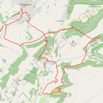
Laurie Lee Wildlife Way
- Distance: 15.0 Km
- Elevation gain: 510 m
- Maximum elevation: 215 m
- Elevation loss: 509 m
- Minimum elevation: 75 m
- Moving time: 3 h 16 m
- Moving speed: 4.6 Km/h
- Maximum speed: 9.4 Km/h
- Total time: 3 h 52 m
- Global speed: 3.9 Km/h
- Date: 06/05/2024
Interactive map
GPS track profile
About this GPS track
Name: Laurie Lee Wildlife Way GPS track, route, trail
Coordinates: 51.75807 -2.20546 51.78438 -2.15802
Other GPS tracks
Click on a GPS track to view route, its statistics and profile.
Dean2023-311
United Kingdom > England > Oxfordshire > Oxford
Distance: 310.3 Km • Elevation gain: 3,366 m • Maximum elevation: 290 m