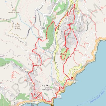
D'Amalfi à Ravello par les escaliers
Interactive map
GPS track profile
About this GPS track
Name: D'Amalfi à Ravello par les escaliers GPS track, route, trail
Coordinates: 40.63353 14.60058 40.65351 14.61375
Other GPS tracks
Click on a GPS track to view route, its statistics and profile.
Le sentier des dieux
Italie > Campanie > Salerno > Pogerola
Randonnée entre Amalfi et Positano. #Randonnée #Méditerranée #Mer #Nature
Distance: 22.1 Km • Elevation gain: 2,092 m • Maximum elevation: 570 m
Percorso selezionato
Italie > Lombardie > Côme > Côme
Percorso calcolato con http://www.bicitalia.org/it/routing-gpx
Distance: 1,543.9 Km • Elevation gain: 17,951 m • Maximum elevation: 1,034 m
Valle delle Ferriere
Italie > Campanie > Salerno > Pogerola
Distance: 9.8 Km • Elevation gain: 735 m • Maximum elevation: 482 m
Le sentier des dieux
Italie > Campanie > Salerno > Pogerola
Entre Amalfi et Positano.
Distance: 21.5 Km • Elevation gain: 2,052 m • Maximum elevation: 567 m
Valle delle Ferriere
Italy > Campania > Salerno > Pogerola
Distance: 9.8 Km • Elevation gain: 735 m • Maximum elevation: 482 m