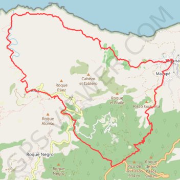
Anaga - Taganana
En boucle depuis Las Casas de la Cumbre, par Afur puis Taganana. #meïnaelya. #Boucle
- Distance: 14.9 Km
- Elevation gain: 1,261 m
- Maximum elevation: 854 m
- Elevation loss: 1,263 m
- Minimum elevation: 14 m
- Moving time: 4 h 14 m
- Moving speed: 3.5 Km/h
- Maximum speed: 9.8 Km/h
- Total time: 5 h 21 m
- Global speed: 2.8 Km/h
- Date: 07/02/2018
Interactive map
GPS track profile
About this GPS track
Name: Anaga - Taganana GPS track, route, trail
Coordinates: 28.54068 -16.25397 28.56995 -16.21810
Other GPS tracks
Click on a GPS track to view route, its statistics and profile.
Anaga - Taganana
Espagne > Santa Cruz de Ténérife
Distance: 14.9 Km • Elevation gain: 1,260 m • Maximum elevation: 854 m